Lab mission
本研究室では合成開口レーダ(SAR)によるデータを解析し,災害監視・インフラ監視を行う手法の研究開発を行っています。特に,「宇宙・地上」からの両領域におけるデータを利用した複合リモートセンシングの社会実装を推進しています。以下が主要な活動内容です。これら社会実装を通じて計測精度や効率を高めるためのアルゴリズム開発を行ってます。
Our laboratory is engaged in the research and development of methods for analyzing data from Synthetic Aperture Radar (SAR) for disaster monitoring and infrastructure monitoring. In particular, we are performing the societal implementation of both “space and ground” SAR domains. The main activities in our lab are as follows. Through these societal implementations, we develop algorithms to enhance measurement accuracy and efficiency.
- 衛星SARによるインドネシア熱帯泥炭地計測 / Tropical peatland monitoring in Indonesia by spaceborne SAR
- 衛星SARによるインフラ計測 / Infrastructure monitoring by spaceborne SAR
- 衛星SARによる地滑り計測 / Landslide monitoring by spaceborne SAR
- 地上設置型SARによる地滑り計測 / Landslide monitoring by ground-based SAR
- 地上設置型SARによるインフラ計測 / Infrastructure monitoring by ground-based SAR
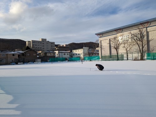
- 地上設置型SARによる積雪計測 / Snow parameter retrieval by ground-based SAR
- ドローン搭載SARの開発 / Development of drone-borne SAR
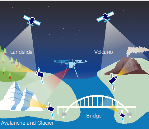
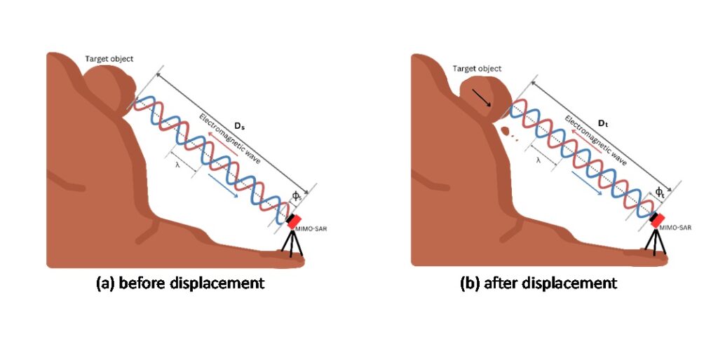
SARは離れた場所から対象に電波を照射し,反射波を解析して対象を画像化(二次元,三次元計測)する技術です。得られたデータを時系列解析することで,地表の動き(変位)を定量的かつ面的に高精度で計測することができ,これはインフラ点検,火山観測,地殻変動など,様々な場面で活用されています。
SAR (Synthetic Aperture Radar) is a technology that produces 2D or 3D image of the target with the radar technology. By performing time-series analysis on the obtained data, it is possible to measure surface movements (displacement) with high accuracy and in a spatially comprehensive manner. This is utilized in various fields such as infrastructure inspection, volcano monitoring, and crustal deformation.
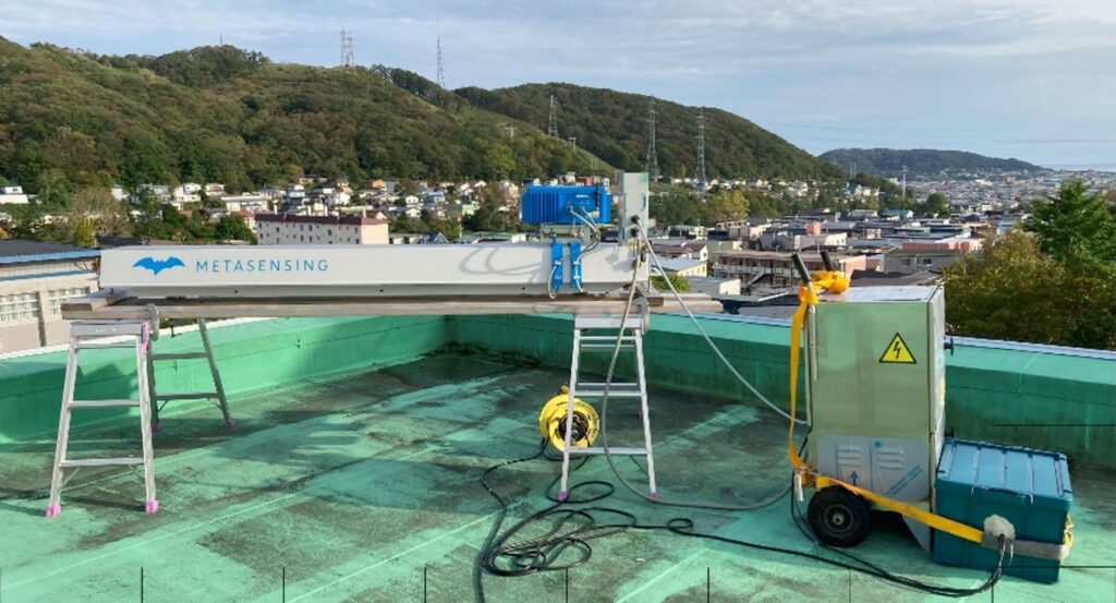
Development and implementation of GB-SAR
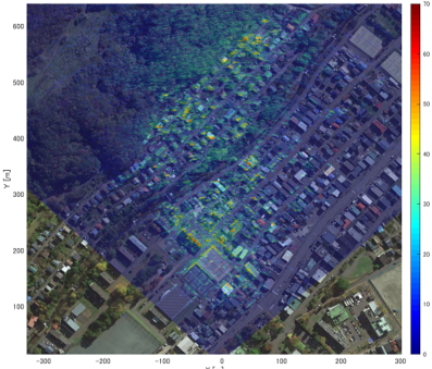
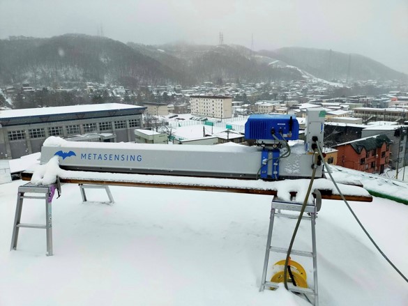
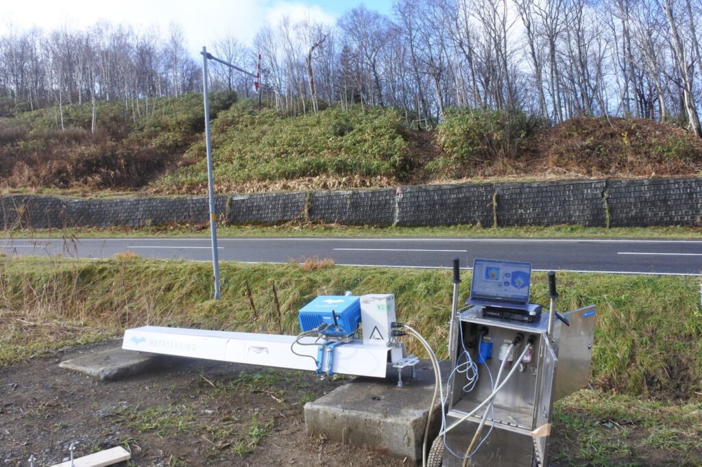
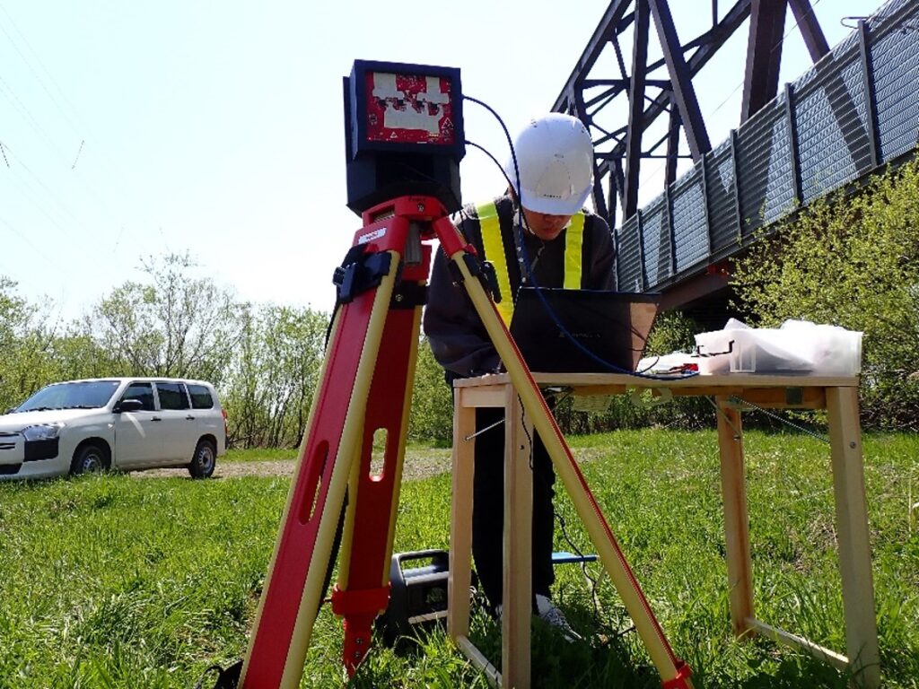
衛星SARは広範囲の観測データを提供できますが,衛星の回帰日数に物理的な限界があるため観測間隔は数日カントリアルタイム性に乏しく,緊急時の機動的な観測ができません。そのため,衛星プラットフォームだけでなく,UAVや地上センサとしてSAR技術を利用するといったアプローチが研究されています。地上設置型SARはレールの上をアンテナが走査することで画像を得るセンシング技術です。研究室が有するシステムはおよそ10秒に一枚画像を取得できるため準リアルタイムで計測が可能です。本研究室ではGB-SARを利用して自然斜面計測やインフラ計測などを実施しています。
Spaceborne SAR can provide wide-area observation data, but due to the limitations of satellite revisit times, the observation intervals span several days, lacking real-time capabilities and making it difficult to conduct agile observations during emergencies. Therefore, approaches utilizing SAR technology not only from satellite platforms but also from UAVs and ground sensors are being studied. Ground-based SAR (GB-SAR) is a sensing technology that obtains images by scanning an antenna over a linear rail. The GB-SAR system in our laboratory can acquire an image approximately every 10 seconds, allowing for near real-time measurement. Our laboratory conducts measurements of natural slopes and infrastructure using GB-SAR.
現在,キャンパス周辺のレーダ画像を5分間隔で連続的に取得しています。すでに1年以上のデータを集めており,降雨や降雪,気温変化がGB-SAR計測に与える影響等を調査しています。
Currently, we are continuously acquiring radar images around the University campus at 5-minute intervals. We have already collected seasonal data and are investigating the effects of rainfall, snowfall, and temperature changes on GB-SAR measurements.
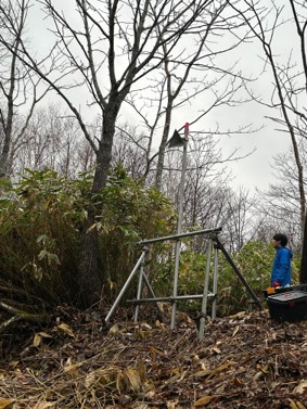
現場に利用可能な電源がない場合,数週間ごとに単発的に観測を行う「非連続観測」を行います。これにより長期の地滑り計測などが可能となります。また,植生に覆われている箇所は計測が困難なためコーナリフレクタなどを設置することで計測を行っています。
In cases where no power source is available on-site, we conduct ”discontinuous observations” every few weeks. This allows for long-term measurements of landslides and other phenomena. Additionally, since areas covered with vegetation are difficult to measure, we install corner reflectors to facilitate the measurements.
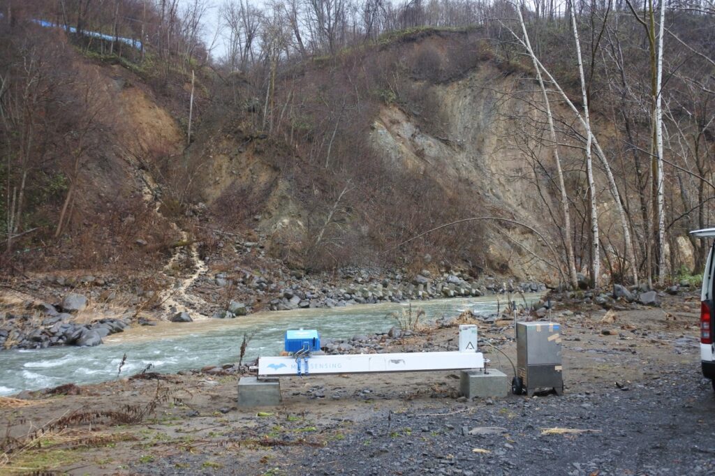
Landslide measurement by GB-SAR
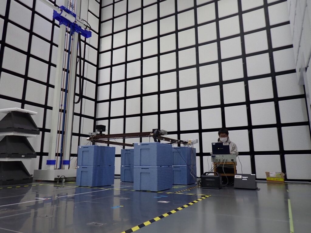
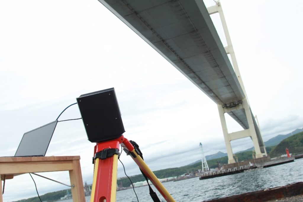
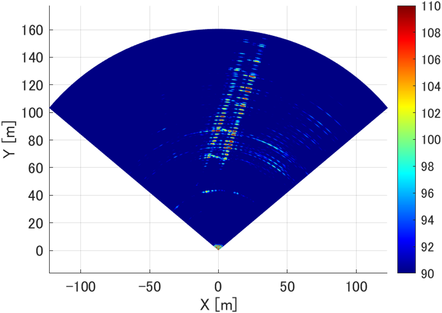
Development and implementation of MIMO radar
レールと一体となったGB-SARシステムは機械的な移動を伴うことから一枚の画像取得に数秒程度要します。これでは対象の振動情報を取得することができません。そこで,振動計測を必要とするインフラモニタリングのため,そもそもレールを使用せずにSAR画像を取得できるMIMO(Multiple-Input and Multiple-Output)型レーダの開発・社会実装を行なっています。
The GB-SAR system integrated with rails involves mechanical movement, taking several seconds to acquire a single image. This makes it impossible to capture the vibration information of the target. Therefore, for infrastructure monitoring that requires vibration measurement, we are developing and implementing a MIMO (Multiple-Input and Multiple-Output) radar that can acquire SAR images without using rails.
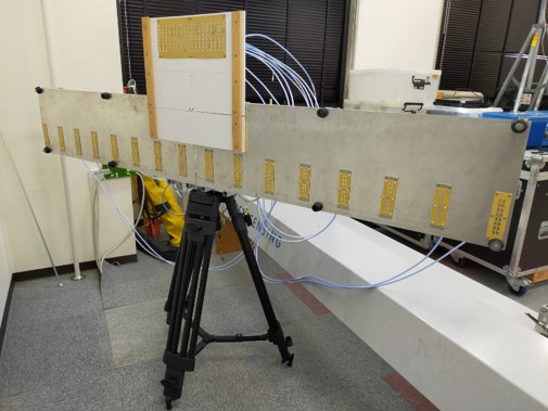
MIMIO radar system in our laboratory
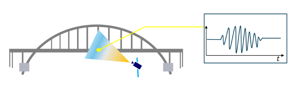
MIMOレーダにより橋梁などの社会インフラの振動を計測することで,内部劣化を診断する技術を開発しています。
We are developing technology to diagnose internal deterioration by measuring the vibrations of social infrastructure, such as bridges, using MIMO radar.
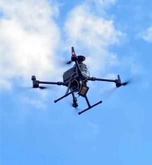
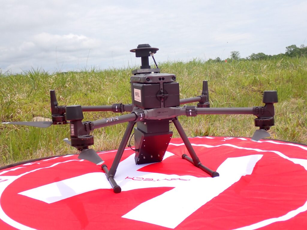
Development of Drone-borne SAR
レーダをドローンに搭載しSARイメージングを行うことで,緊急時機動的に広範囲の計測を行うことができます。研究室ではドローンSARの開発から,イメージングアルゴリズムの開発,インターフェロメトリ手法の開発などを進めています。
By mounting a radar onto a drone (UAV), it is possible to perform wide-area measurements quickly and efficiently in emergency situations. Our lab is developing drone-borne SAR systems, its imaging algorithms, and its interferometric techniques.